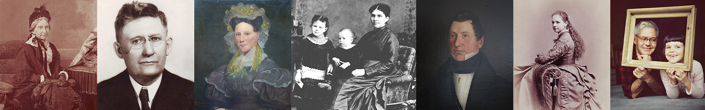
By Janice Hamilton and Justin Bur
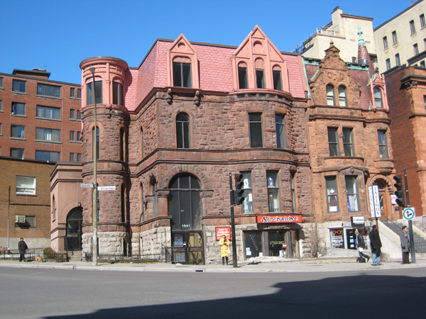
The commercial building that occupies the northeast corner of Sherbrooke Street West and Cote des Neiges Road in downtown Montreal was built as a family home in 1891 by my great-grandfather Robert Stanley Bagg (RSB). That makes the house more than 130 years old, but thanks to Montreal’s system of recording property sales, it is possible to trace the history of the lot back to the 1700s.
I had asked my friend Justin Bur, an urban history researcher and expert in researching property records, about the building that is attached to my ancestor’s house. I wondered whether RSB had built it, and if not, why it so closely resembles the Bagg house. Using the old cadastral lot number of the Bagg house—lot 1728 of St. Antoine Ward—Justin came up with the following story.
***
Just behind the Bagg house runs a 17th-century line separating agricultural land from the land reserved for the Sulpician priests’ First Nations mission on and around Mount Royal. This line runs north-northeast from approximately the corner of Sherbrooke and Fort to Milton and University. In the 1690s, the Sulpician mission was moved from the bottom of Mount Royal, north to the Rivière-des-Prairies. The Sulpicians planned to give up much of the mountain slope to allow for the creation of agricultural lands for settlers in Côte Sainte-Catherine, Côte-des-Neiges, and Côte Saint-Antoine. For themselves, they retained some of that land and expropriated a bit more. There, they built a country retreat that later became the site of the Grand Séminaire and the Collège de Montréal.
This is where fur trader and explorer Alexander Mackenzie comes into the picture. He was the first person of European origin to cross northern North America by land. On his first great expedition, in 1789, he followed the river that now bears his name to the Arctic Ocean. In a historic 1793 expedition, he reached the source of the Peace River in the Rockies, crossed the continental divide, and reached the Pacific Ocean.
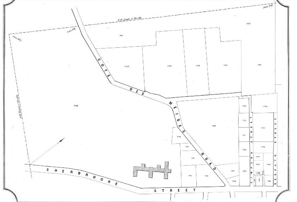
Mackenzie then spent several years in Montreal, where he invested in land. At the beginning of the 19th century, he purchased an orchard, along with a strip of the mountain, then acquired another strip of land along the east side of the Sulpician domain. Côte-des-Neiges Road veers to the west at the midpoint between these two properties. Nearby there was a triangular piece of Sulpician land, adjacent to Mackenzie’s orchard but separated from the rest of the priests’ domain by the road. Mackenzie acquired that parcel in December 1804, and this triangle includes the site of the Bagg house.
Mackenzie spent little time in Canada after 1805 and died in Scotland in 1820. His land in Montreal was probably rented. Finally, in 1845, a subdivision plan was drawn up and the whole property was sold to Sir George Simpson, governor of the Hudson’s Bay Company.
The following year, Simpson sold lot 40 of the subdivision plan – a chunk of the triangle – to brush maker Thomas Jenking. Jenking built a two-storey brick house there, just northeast of where the Bagg house later stood. In 1857, Jenking sold the property, and in 1862 it was resold to a banker.
https://numerique.banq.qc.ca/patrimoine/details/52327/2244456
In 1890, Warden King, who had made a fortune manufacturing central heating equipment, bought the property. He then divided it into three parts: the western lawn along Côte-des-Neiges; the centre part containing the old Jenking house; and the eastern lawn. King never lived there; the house had been rented a few years previously to the manager of a telephone company. At this point, the Bagg family arrived on the scene.
On June 25, 1891, Robert Stanley Bagg (1848-1912), a lawyer who managed his deceased father’s extensive properties on the Island of Montreal, purchased the western lawn from King. This property corresponds to current lot numbers 1065572 (the RSB house) and 1065571 (an outbuilding on the Côte-des-Neiges side, currently a convenience store). RSB had plans for a red sandstone house drawn up by architect William McLea Walbank (1856-1909). The house had the street address 1129 Sherbrooke Street, but over the years the street numbering system changed more than once, and it is now at 1541 Sherbrooke St. West.
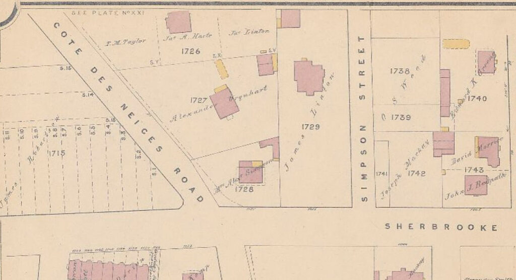
On the same day, RSB’s mother, Catharine Mitcheson Bagg, purchased the eastern lawn from King. Six months later RSB’s brother-in-law Albert E. Lewis purchased the centre lot containing the old house. In January, 1892 Lewis sold that centre lot to RSB, and at the end of the month, RSB’s mother sold her son a three-foot strip along the west side of her property. A year later, RSB and his mother ceded the centre and eastern lots to Thomas Collins in exchange for a property on the northwest corner of Sherbrooke and Hutchison, near McGill University. There was no mention of the old house and outbuildings, which had likely been demolished.
Collins signed an agreement stating that he would build a house that closely resembled RSB’s residence. The attached building was to have a facade of red stone on a foundation of grey stone and sit on a line with the residence of RSB, with no bay windows or porch projecting more than three feet, three inches from the front of the building. In addition, Collins was to build an entirely separate and distinct side wall adjacent to the gable wall of RSB’s house.
***
Records show that in 1895 Collins hired architect William Edward Doran to design a house on Sherbrooke Street. This was likely the house attached to the Bagg house that I had asked Justin about.
Two years later, Lovell’s Montreal street directory listed G. H. Smithers at 1127 Sherbrooke Street. George Hampden Smithers was the brother of RSB’s wife, Clara Smithers. Smithers must have rented the house from Collins initially, but in 1899, Collins sold that house to Frances Clark Cook, wife of George Hampden Smithers. The vendor certified that the house, with its red sandstone façade and separate side wall, conformed to RSB’s deed of exchange of 1893.
All of that to explain that the house attached to RSB’s home did not belong to my direct ancestors, but to my great-grandmother’s brother, and that it was designed to appear similar to the Bagg house.
Notes
Here are further notes from Justin Bur on researching property in Montreal:
A cadastre is a system to record and map the size, location and ownership of real estate property, unambiguously over a large territory. It is used to identify property in sales and leases and for tax purposes. In Montreal, you can find the cadastral lot number of your property on city tax assessment documents and on cadastral maps. The Bibliothèque et Archives nationales du Québec BAnQ) has a large collection of digitized maps and diagrams (cartes et plans) online, including cadastral maps from 1874, 1879, 1881, 1890, 1907 and 1914. See https://numerique.banq.qc.ca/ressources/details/cart
When the cadastre was created in the mid-1870s, it was organized according to the municipalities (and in Montreal, the municipal wards) of the time. (Our lot 1728 is in the cadastre of Saint-Antoine ward.) Starting in the 1990s, a single cadastre for the entire province of Quebec was put into place, with 7-digit lot numbers. If you want to do a property record search, according to cadastral lot numbers, you need to use the Registre foncier du Québec, https://www.registrefoncier.gouv.qc.ca/Sirf/. That’s where I found much of the source material for this story.
Information on property owners can also be found from the municipal property tax assessment rolls (rôles d’évaluation), which are held at the Archives de la Ville de Montréal. They are arranged by municipal wards. Ward boundaries evolved over time and some wards were split. In 1921, moreover, major changes were made to the ward system. See Lovell’s map of Montreal 1920, https://numerique.banq.qc.ca/patrimoine/details/52327/2243931 and with the 1921 changes added, https://archivesdemontreal.ica-atom.org/1920-3-lovells-map-of-city-of-montreal-including-westmount-outremont-verdun-montreal-west-and-st-laurent-john-lovell-son-limited-publishers-of-lovells-montreal-directory-every-year-since-1842-1920
Once you’ve got the right municipal ward, you can browse the assessment rolls by street address. Cadastral lot numbers are a good check to make sure you’ve got the right property. Even and odd street numbers are in separate listings. I checked St-Antoine Ward, west section, 1900 as a test. After getting to the end of Sherbrooke even numbers, we find Sherbrooke odd numbers. The Bagg house is listed with the lot number “pt 1728”. This roll, for property tax purposes, lists only owners (no tenants).
One more point of detail: until 1905, the street numbers are on Sherbrooke Street (period), no West. That was the case when the houses were numbered 1127 and 1129. The origin point of the street was somewhere arbitrary in the east end. So in 1905, when the origin point moved west to Saint-Laurent Blvd., the numbers had 390 subtracted from them. Then in 1928 the street number increased greatly, because a new street address numbering system came into effect, made to handle a much higher density of numbers. These numbers are still in use today.
See also:
A Montreal Landmark, Writing up the Ancestors, Dec. 7, 2022, https://www.writinguptheancestors.ca/2022/12/a-montreal-landmark.html
Fairmount Villa, Writing up the Ancestors, Dec. 18, 2019, https://www.writinguptheancestors.ca/2019/12/fairmount-villa.html
Mrs. Robert Stanley Bagg, Writing up the Ancestors, March 7, 2014, https://www.writinguptheancestors.ca/2014/03/mrs-r-stanley-bagg.html